Distance: 2 ½ miles / 4km – A couple of hours at a leisurely pace
Top tip: look out for the green and white arrows to ensure you are on the right track!
Please ensure dogs are kept on a lead at ALL times as our livestock are free to roam anywhere on our farm.
1. From the campsite walk down the lane and out through the farm entrance gate onto an area of moorland known as Pendrift Downs. Please note – if you are camping with a dog, you can access the trail through the dog exercise field through a gate to the left, then bear slightly right and skip to point 4.
All of the common land on Bodmin Moor is still owned by a ‘Lord of the Manor’ but the right to graze animals (or cut turf, or feed the acorns to pigs!) belongs to the ‘commoners’ (like us) who have farms that touch the moor.
2. Once through the gate and over the little bridge next to the ford, take the fork off to the right and follow the track down to another ford and passing over a cattle grid.
3. Follow this track up through a ‘protected’ area that is not stocked at all during the winter and only very lightly in the summer.
This management reflects the importance of the field’s fauna and flora, and in the boggier areas the presence of plants such as Pale Butterwort (Pinguicula lusitanica) and Bog Asphodel (Narthecium ossifragum) indicates that it is a wildlife habitat of high nature conservation value. To your left you will have panoramic views of the county from the china clay works at St Austell in the south up to the Camel Estuary and even a glimpse of the sea (on a fine day) to the north.
4. Do not follow the track over the next cattle grid, which leads to a private residence. Instead, when you are about 50 metres from the second cattle grid, turn left off the track and head left down a footpath, bending into a narrow shaded path we call the Gallery.
You now find yourself walking along the head of an ancient woodland called The Coombe which stretches out of sight below you. Because the terrain is so inaccessible this woodland has gained international importance as it has remained untouched for centuries and contains many rare and interesting lichens which you can see clinging to the trees.
As you approach the end of the Gallery you can look back at the full extent of woodland and beyond, and you have a view of a lonely piece of moorland known as Pendrift Bottoms. Pretty though it might be it is extremely hard to get to – there are only two precipitous paths down a steep slope to it and you need a brave pony and a clever dog to retrieve any sheep which might have wandered down.
5. On through the next gate and the footpath which will lead you up to see the whole of the historic De Lank quarry laid out below you and views out over the camel estuary.
Quarrying started in the 1840s and the exceptional quality of the silver-grey granite made it highly desirable in the construction of bridges, lighthouses and other engineering works. For over 100 years it employed many of the men from both of the local villages and even piped the De Lank River to drive turbine engines.
The Eddystone – and several other lighthouses – came from here, while to your right is The Canyon, the spectacular entrance road to the quarry which was cut through the hillside. In more recent times the stone for the Princess Diana Memorial Fountain in Hyde Park, and the Eden Project’s giant ‘seed’ came from here.
The steep valley side at your feet is home to the nationally rare (and endangered) Pearl-bordered Fritillary butterfly which favours undisturbed South-west facing slopes with plenty of violets for the caterpillars to feed on.
6. At this point you can leave the footpath and bear off to the right up into the field and you will come across a settlement of well preserved bronze age hut circles and reeves (prehistoric field systems) – evidence that shows that South Penquite has been farmed now for over four thousand years.
7. Head back onto the path and walk now towards disused Hantergantick Quarry and you will drop down through a gate towards the beautiful and picturesque De Lank River – follow the information posts down to the riverbank path.
The fence stopping the livestock from getting to the river was erected to maintain a wildlife corridor. The river has been graded in the top five rivers in Europe for water purity and biodiversity, and was designated a SAC (Special Area of Conservation) by Natural England in recognition of its international importance to the otter and Bullhead fish.
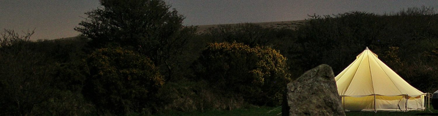
8. After a few hundred yards along the river bank you will come across our Story Circle – the stone bench ends, which align with North, South, East and West, are carved with the symbols of the elements. After here you can continue on the river path which eventually leads you up into our furthest field – Ryedown, which contains a striking standing stone. Along this section of the river path you will find some great spots for a wild swim if you’re brave.
This imposing stone is thought perhaps to be the remains of a prehistoric kerbed Cairn which would have been a highly visible landmark in the sacred Bronze Age landscape. From the stone you can also see one of the most popular beauty spots on Bodmin Moor – Delphi Bridge (De Lank Ford Bridge).
9. From the standing stone head up to the entrance gate in the new deer fence which protects our new native woodland and pass through heading for a similar gate at the top of the plantation.
There is a granite bench in the centre of the woodland from which you can view the standing stone in a wider view of the moors including Cornwall’s two highest tors – Roughtor and Brown Willy
10. Once through the top gate – making sure that you close it securely behind you – follow the fence to the right until you reach a water trough with a gate to the right and another gate a little way off to the left. This is the gate you need to continue your walk.
As you skirt one of our largest fields you might notice some newly planted copses of trees which we have planted to provide shade for livestock as we experience ever more frequent and intense heatwaves.
11. Once through the gate follow the gorse row on your right for quite some time until you eventually come to a wooden gate, go through and turn left through a narrow track coming up into the next field.
12. Head for our windmill and straight through the wooden gate (look for the arrows).
13. If you are with a dog, please then enter back into the campsite through the dog exercise field, all other campers can head back in through the small wooden gate in the middle of the farthest hedge.