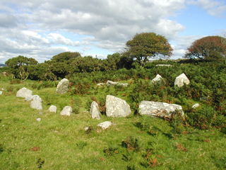
Bodmin Moor covers approximately 400sq km and is the largest of the Cornish granite uplands. It has a wealth of archaeological remains that few parts of Britain can equal. The level of preservation means that you can still pass through the doorways of prehistoric huts and deserted medieval longhouses, walk across abandoned field systems and visit the derelict remains of the quarrying and mining industries
The defining characteristics of South Penquite’s historic landscape are its well preserved medieval field system with its boundaries and associated settlements; its extensive nationally important Bronze Age landscape of hut circles, field systems and cairns; its history of stone extraction including the De Lank quarry complex; an area of tin streaming; and its historic mix of improved ground and rough pasture
In January 2005 the Projects team of the Cornwall County Council Historic Environment Service was commissioned to carry out an archaeological assessment of their farm which was funded through Natural England’s ‘Aggregate Levy Sustainability Fund’
Map showing the key features from the three main sections of the report can be found here:
- Prehistory and Romano-British period (to AD 410)
- Medieval period (AD 410 to AD 1540)
- Post-medieval period: 1540 to present
The full report can be downloaded by right clicking here and selecting ‘Save Target As…’
